Wind Energy – Geophysical Survey
Belgium-headquartered G-Tec, part of the DEME Group, has won a contract to conduct a geophysical survey for ELWIND, the Estonian-Latvian cross-border offshore wind project.
The company, under a contract worth a little over EUR 3.6 million, will perform a geophysical survey and ground model development for the ELWIND offshore wind farm areas.
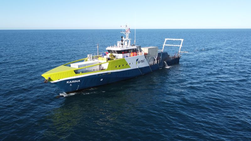
Starting in early September, the 55-meter research vessel Karina will begin profiling the seabed in the ELWIND offshore wind farm areas in Estonia and Latvia. The survey is expected to last approximately two months.
The objective of the survey is to collect high-resolution geophysical data to support the planning and preliminary design of future offshore wind farms. Key focus areas include:
• Mapping seabed and subsurface conditions using bathymetric and seismic-acoustic data to develop ground models.
• Identifying objects and hazards – Detecting large boulders, previously unknown shipwrecks, unexploded ordnance (UXOs), and chemical warfare remnants.
• Environmental baseline mapping – Producing sediment maps and backscatter imagery to support benthic habitat assessments.
• Optimizing future geotechnical investigations – Defining sampling locations, methods, and scope based on the ground model.
• Reducing design risks by ensuring that concept development is based on reliable geological data.
The ELWIND project aims to develop offshore wind sites in Latvian and Estonian territories and establish the fourth electricity interconnection between the two countries.Type / to choose a block
